How to Navigate Any Ski Resort Like a Local
The Problem: Getting Lost at Ski Resorts
Every skier has been there. You’re standing at the top of a chairlift at an unfamiliar resort, staring at a trail sign with eight different directions, and you have absolutely no idea which way to go. The paper trail map you picked up at the lodge? It blew out of your pocket on the last run. Even if you still had it, those cartoon-style illustrations rarely match what the mountain actually looks like when you’re standing on it.
Getting lost on a ski mountain isn’t just annoying — it can be genuinely stressful. Beginners accidentally wander onto expert terrain and find themselves staring down a mogul field they have no business being on. Families get separated because one person takes a wrong fork. Visitors at large resorts like Perisher or Coronet Peak can spend half their day just figuring out how to get from one base area to another.
Traditional trail maps have barely changed in decades. They’re beautiful as art, but they distort perspective, flatten the terrain, and give you almost no sense of where you actually are on the mountain. There’s no “you are here” dot that moves with you. There’s no way to ask, “How do I get from this lift to that run?”
Meanwhile, we all have GPS devices in our pockets that can navigate us turn-by-turn through city streets. So why can’t we do the same thing on a ski mountain?
How GPS Navigation Works on the Mountain
Ski resort navigation works on the same principle as road navigation, but the underlying map data is completely different. Instead of streets and intersections, a ski resort map is built from three types of features:
- Runs — the skiable trails, each with a difficulty rating (green, blue, black, double-black)
- Lifts — chairlifts, gondolas, T-bars, and magic carpets that move you uphill
- Connections — traverses, cat tracks, and paths that link different areas of the resort
These features are stored as GeoJSON — a geographic data format that encodes the exact GPS coordinates of every run, lift, and connection on the mountain. Think of it as a detailed road network, but for skiing. Every junction where runs split, every lift station, every cat track that crosses between areas is precisely mapped.
Once the map data exists, route calculation works similarly to how Google Maps finds you the fastest way to work. The app knows your GPS position, knows every possible path on the mountain, and calculates the sequence of runs, lifts, and connections that gets you from where you are to where you want to go.
But there’s an important difference: difficulty matters. A route that sends a beginner down a double-black diamond isn’t helpful — it’s dangerous. Good ski navigation factors in your ability level and avoids terrain you can’t handle.
Turn-by-Turn Directions for Every Run
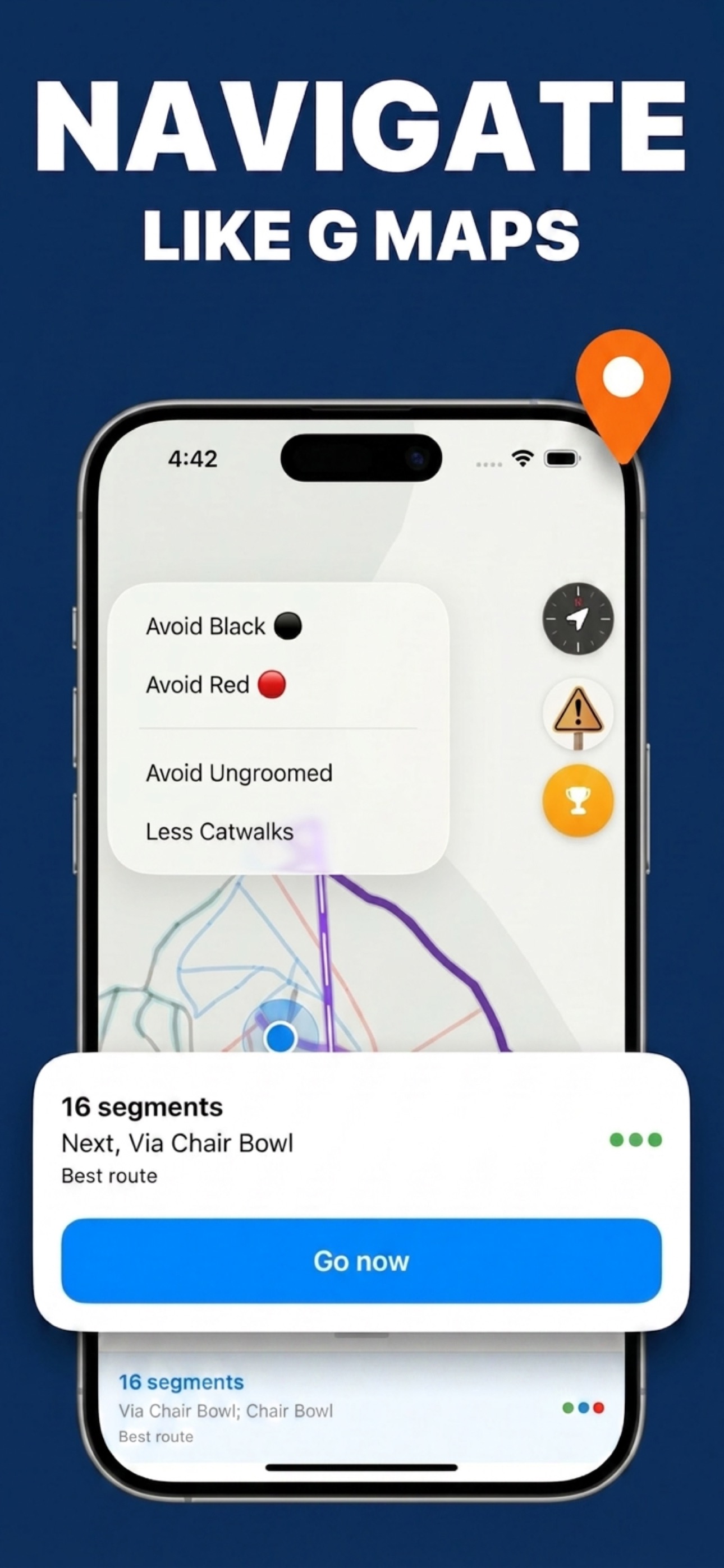
Here’s how turn-by-turn navigation actually works on a ski mountain. First, you select your destination — maybe it’s a specific run you’ve heard about, or a lodge where you’re meeting friends for lunch. The app calculates the best route from your current GPS position.
That route is broken into clear segments:
- “Take Eagle Express chairlift to the summit”
- “Ski Cruiser (blue) to the junction”
- “Bear right onto Traverse Path”
- “Take Village Chair to the base area”
As you ski, the app tracks your position and advances through the segments. If you take a wrong turn — maybe you went left when you should have gone right — the app recalculates from your new position, just like a car GPS would.
This is particularly valuable in situations that paper maps handle poorly: connecting between different resort zones, finding your way back to a specific base area, or navigating during flat light when visibility is low and everything looks the same. Instead of guessing at trail signs, you have a clear sequence of steps on your phone or watch.
Navigation also helps you discover new terrain. Instead of sticking to the same three runs you know, you can confidently explore different areas because you know the app can always guide you back.
How SnowRun Helps
SnowRun was built specifically to solve the navigation problem at ski resorts. Every route segment is color-coded by difficulty — green for beginner, blue for intermediate, black for advanced — so you can see at a glance what terrain you’ll be skiing. Before you start navigating, you know exactly what you’re getting into.
The app lets you set your skill level, and routes automatically filter out runs that are above your ability. A beginner will never be directed down a black diamond, even if it’s technically the shortest path. This makes SnowRun particularly useful for families with mixed ability levels and for anyone skiing a resort for the first time.
All maps work offline. You download the resort map when you’re connected to WiFi — at your hotel, in the lodge, wherever — and navigation works without cell service on the mountain. This matters more than you might think. Many ski resorts, especially in New Zealand’s South Island and parts of rural Australia, have patchy or nonexistent mobile coverage once you leave the base area.
SnowRun currently covers over 31 resorts across Australia and New Zealand, with every run, lift, and connection precisely mapped. Each resort also includes patrol phone numbers, so if something goes wrong on the mountain, help is one tap away.
Navigate your next resort with confidence
Turn-by-turn directions for every run, lift, and trail — free on iOS.
Download SnowRunFrequently Asked Questions
Is ski resort navigation like Google Maps?
Yes, the concept is the same. SnowRun maps every run, lift, and connection at a resort as precise GPS data, then calculates the best route from your location to your destination. You get step-by-step directions through specific runs and lifts, and the app recalculates if you take a wrong turn.
Does navigation work without cell service?
Yes. Download the resort map while you’re on WiFi and navigation works entirely offline using your phone’s GPS. No mobile coverage needed on the mountain.
Can I avoid expert runs in my route?
Yes. Set your skill level in the app and SnowRun will only route you through runs at or below your ability. Beginners won’t be directed onto black diamonds, even if that’s the shortest path.