How to Read a Ski Trail Map: Beginner’s Guide
Walking up to a ski resort trail map for the first time can feel like staring at a subway map in a foreign city. Lines criss-cross in every direction, strange symbols dot the landscape, and the whole mountain is squashed into a single flat image. But trail maps follow a consistent system — once you understand the basics, you can read the map at any resort in the world.
This guide breaks down the color codes, symbols, and conventions used on ski trail maps, and explains why more skiers are switching to digital maps that show their real-time position on the mountain.
Understanding Trail Difficulty Colors
Every ski resort uses colored markers to indicate how difficult a trail is. The specific colors vary slightly between regions, but the underlying system is universal — easy runs get the lightest color, expert runs get the darkest.
In North America, Australia, and New Zealand, the standard system is:
- Green circle — Beginner. Wide, gently sloping groomed runs. Perfect for first-timers and those still building confidence on skis or a board.
- Blue square — Intermediate. Steeper than green, sometimes with moguls or narrow sections. Most resort terrain falls into this category.
- Black diamond — Advanced. Steep, often ungroomed, may include trees, cliffs, or variable snow conditions. Requires strong technique.
- Double black diamond — Expert only. The most challenging terrain the resort offers — extreme steeps, chutes, mandatory air, and backcountry-style conditions.
In Europe, the system uses different colors:
- Green — Easiest (nursery slopes)
- Blue — Easy to intermediate
- Red — Intermediate to advanced
- Black — Expert
Some European resorts add orange to mark extreme off-piste routes or itinerary runs that are marked but not patrolled or groomed.
One important thing to remember: difficulty ratings are relative to each resort. A blue run at a steep Alpine resort might feel harder than a black diamond at a smaller hill. The colors tell you how a trail compares to other trails at that specific mountain, not across all mountains everywhere.
Reading Map Symbols
Beyond trail colors, resort maps are covered in symbols that tell you what infrastructure exists on the mountain. Knowing these saves time and prevents frustration — nobody wants to accidentally ski down to a base area with no lift back up.
Lifts are the most important symbols to learn. Different lift types have distinct icons:
- Gondola — enclosed cabin, often drawn as a box on a cable. Fastest way up, usually serves the longest runs.
- Chairlift — open seats suspended from a cable, shown as small chairs. May be fixed-grip (slower) or detachable (faster loading).
- T-bar or Poma lift — surface lifts that drag you uphill. Common on beginner slopes and in Europe. Drawn as a line with a small T or disc.
- Magic carpet — conveyor belt for absolute beginners. Usually shown as a short, thick line near the base area.
Facilities you’ll find marked on most resort maps include:
- Lodges and restaurants (fork-and-knife icon or a small building)
- First aid stations (red cross)
- Restrooms
- Terrain parks and half-pipes (often shown with small jump icons)
- Parking areas
- Resort boundaries (dashed lines marking the edge of patrolled terrain)
Pay special attention to resort boundary markers. Skiing beyond the boundary means leaving patrolled, avalanche-controlled terrain. Out-of-bounds skiing is dangerous for beginners and intermediate skiers.
From Paper Maps to Digital
For decades, the standard way to navigate a ski resort was a folded paper trail map. These iconic, hand-illustrated panoramas are works of art — talented cartographers paint the mountain from a bird’s-eye view, labeling every run and lift with careful detail. But paper maps come with real limitations.
The artistic perspective distorts distances and angles. The front of the mountain is exaggerated while the back is compressed, making it hard to judge how far one trail is from another. Paper maps can’t show your current position, so you’re constantly stopping to squint at the map and guess where you are. They blow away in the wind, get soggy in the snow, and require you to remove your gloves to unfold them.
Digital trail maps solve these problems. A GPS-enabled ski map on your phone can:
- Show your real-time position on the mountain as a moving dot
- Zoom in and out to see individual trails or the full resort
- Search runs by name instead of scanning the entire map visually
- Color-code trails by difficulty so you can instantly spot beginner or expert terrain
- Work offline without cell service, which is common on remote mountains
The shift from paper to digital maps mirrors what happened with road navigation. Just as GPS navigation replaced paper road maps for driving, digital trail maps are becoming the default for skiing. You still need to understand what trail colors and symbols mean — but a digital map does the heavy lifting of showing you where you actually are.
How SnowRun Helps
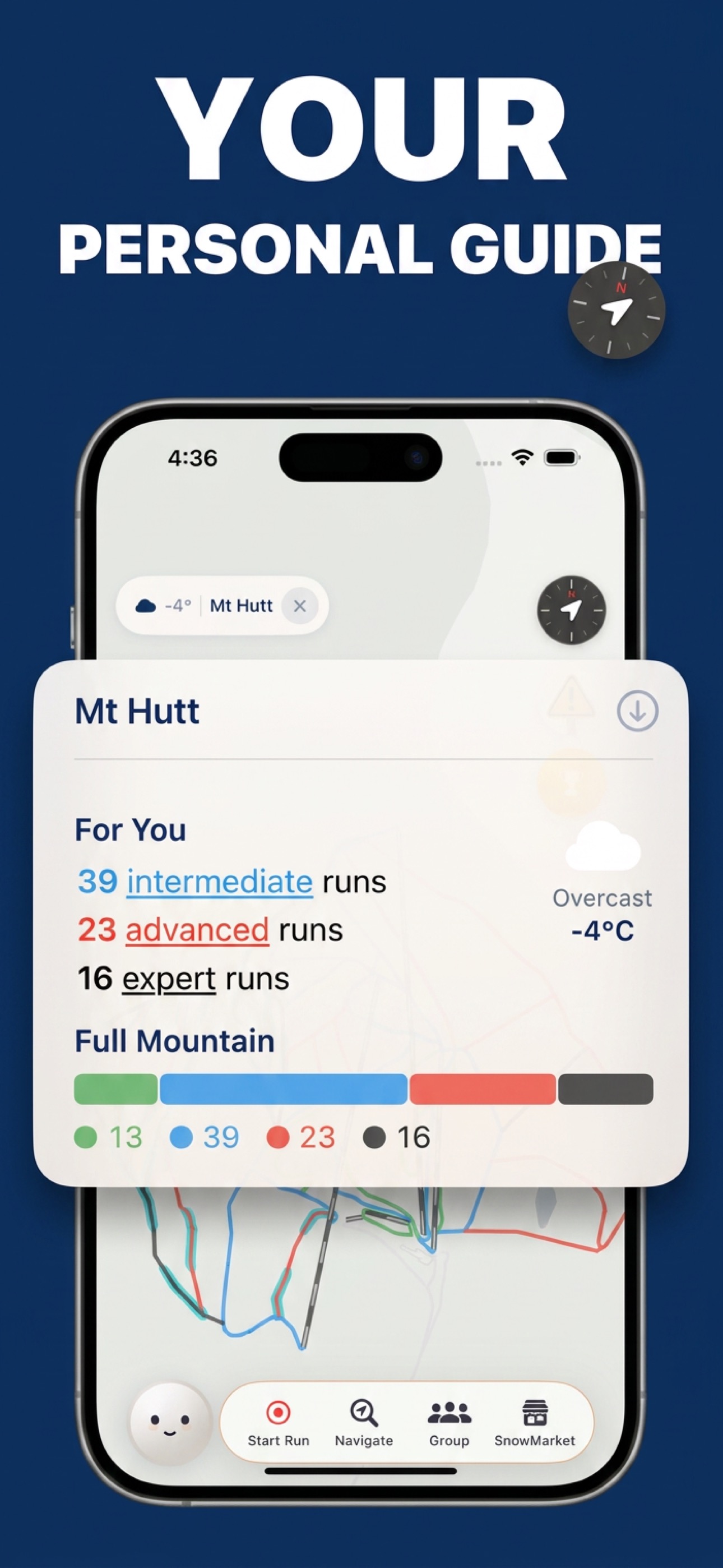
SnowRun was built specifically to make ski resort maps easy to read and navigate. Every trail on the map is color-coded by the international difficulty standard for that region — so a green run in New Zealand and a green run in Colorado both display correctly according to their local rating system.
Your GPS position appears in real time on the map, so you always know exactly which trail you’re on and where the nearest lift or lodge is. You can search any run by name and tap it to see its difficulty, length, and location. If you want to focus on terrain that matches your ability, you can filter trails by difficulty — show only green runs to stick to beginner terrain, or only black diamonds to find the steepest lines.
Need to get somewhere specific? SnowRun’s navigation feature plans a route from your current position to any destination on the mountain — a specific run, a restaurant, or the car park. It accounts for your skill level, so beginners won’t be routed down advanced terrain.
All maps are available offline. Download a resort before you arrive, and the full map works without cell service — essential for mountain areas where coverage is spotty or nonexistent.
Never get lost on the mountain again
GPS trail maps for 31+ resorts across Australia and New Zealand — free to download.
Download SnowRun