Best Ski Apps for New Zealand in 2026
New Zealand’s Ski App Landscape
New Zealand has some of the most spectacular ski terrain in the Southern Hemisphere, but finding a ski app that actually covers it well is surprisingly difficult. The global apps — Slopes, Ski Tracks, Strava — tend to focus on North American and European resorts. When they do include New Zealand, it’s usually just the biggest commercial fields like Coronet Peak or Mt Hutt.
That leaves a huge gap. New Zealand has a thriving club field culture that’s unlike anywhere else in the world. Fields like Broken River, Craigieburn, and Temple Basin are run by volunteer clubs, accessed by rope tows or nutcrackers, and offer some of the best ungroomed terrain in the country. These smaller fields are almost never included in international ski apps.
There’s also a practical challenge: New Zealand’s ski fields are often in genuinely remote locations. Many South Island fields are accessed via long gravel roads into the mountains, well beyond reliable cell coverage. An app that needs a constant internet connection is essentially useless at half the ski fields in the country. Any ski app worth using in New Zealand needs to work offline as a baseline requirement, not a premium feature.
Season detection is another issue. New Zealand’s ski season runs roughly from June to October — the opposite of the Northern Hemisphere. Apps built for northern winters sometimes display your July ski data as “off-season” activity or miscalculate your annual stats.
What to Look For in a Ski App
Choosing a ski app for New Zealand comes down to a few key factors. Some matter more here than they would in Europe or North America:
- NZ resort coverage — Does the app cover just the big commercial fields, or does it include smaller club fields and regional ski areas too? NZ has 20+ skiable fields, and you don’t want an app that only knows about five of them.
- Offline maps — This is non-negotiable in New Zealand. Cell coverage at many South Island ski fields ranges from patchy to nonexistent. Your app needs to download maps on WiFi and work entirely offline on the mountain.
- GPS tracking — Accurate run tracking that records your speed, distance, and vertical. Good apps should also auto-detect when you’re on a lift versus skiing down.
- Navigation — Can the app guide you to a specific run? Especially useful at larger fields like Cardrona or the Remarkables, where terrain spans multiple basins.
- Price — Some apps charge $10–$15/month. If you ski 10–20 days a year, that adds up. Look at what’s included in the free tier versus what requires a subscription.
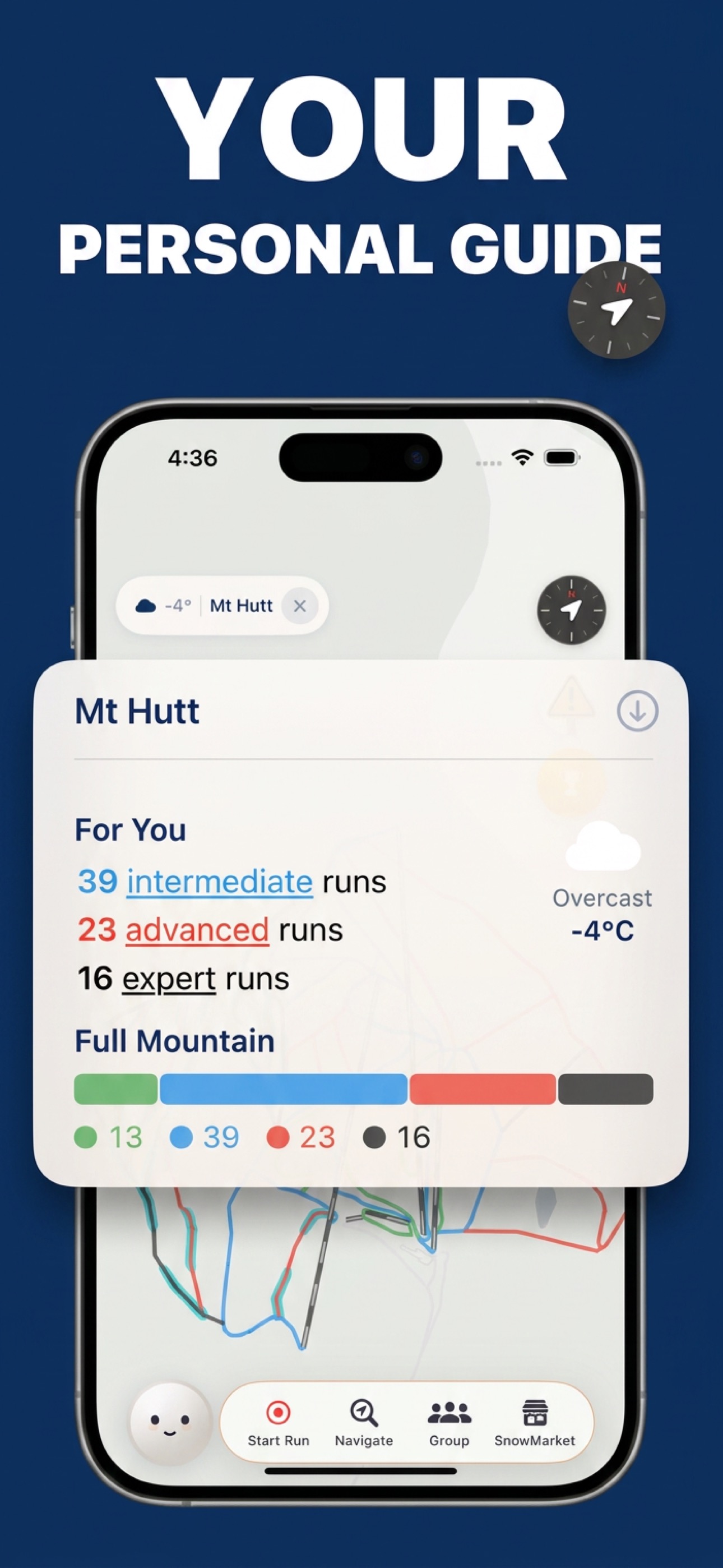
New Zealand Ski Fields Covered by SnowRun
SnowRun covers 20 New Zealand ski fields — from the major commercial resorts to regional fields that most apps ignore. Every run, lift, and connection at each field is mapped with precise GPS data. Here’s the breakdown by region:
Queenstown & Southern Lakes
- Coronet Peak — Queenstown’s closest field, known for night skiing and wide groomed trails
- The Remarkables — Dramatic basin terrain just 30 minutes from Queenstown, with a mix of beginner and advanced runs
- Cardrona — A favourite for families and park riders, with some of NZ’s best halfpipe and terrain parks
- Treble Cone — The biggest vertical drop in the South Island and long, challenging off-piste terrain above Wanaka
- Snow Farm — New Zealand’s premier cross-country skiing venue, high above the Cardrona Valley
Canterbury
- Mt Hutt — Canterbury’s premier commercial field, consistently one of the first to open each season
- Porters — The closest ski field to Christchurch, a popular day-trip destination
- Broken River — A club field with legendary ungroomed terrain accessed by nutcracker tow
- Craigieburn — Steep, expert-oriented club field known for some of the best sidecountry in NZ
- Temple Basin — A club field accessed by a 45-minute walk from the road, with wide-open basins
- Mt Cheeseman — Family-friendly club field in the Craigieburn Range
- Hanmer Springs — A small community field near the Hanmer hot pools
- Mt Olympus — Remote club field with challenging terrain deep in the Craigieburn Range
- Roundhill — Overlooking Lake Tekapo, known for its long rope tow and stunning views
- Fox Peak — South Canterbury club field near Fairlie
- Mt Dobson — A family-oriented field near Fairlie with wide, gentle terrain
North Island
- Whakapapa — New Zealand’s largest ski area by terrain, on the slopes of Mt Ruapehu
- Turoa — The other side of Ruapehu, famous for its long season and spring skiing
- Tukino — A club field on the eastern slopes of Ruapehu, accessed by 4WD only
- Manganui — A small community field on Mt Taranaki in the western North Island
Whether you’re hitting the groomed runs at Coronet Peak or hiking into Temple Basin for the first time, SnowRun has the map data you need.
How SnowRun Helps
SnowRun was built with New Zealand in mind from day one. It’s not a Northern Hemisphere app that added a few NZ resorts as an afterthought — NZ ski fields were part of the initial mapping effort, and the app’s design reflects the realities of skiing in this country.
All 20 NZ ski fields mapped. SnowRun covers every significant ski field in New Zealand, from the major commercial operations like Coronet Peak and Mt Hutt down to club fields like Broken River and Temple Basin. Every run, lift, rope tow, and connection is mapped with GPS-accurate data.
Offline maps are essential here. Many of New Zealand’s best ski fields — Craigieburn, Broken River, Mt Olympus, Tukino — have zero cell coverage. SnowRun lets you download the complete resort map on WiFi before you leave town. Navigation and GPS tracking work entirely offline using your phone’s built-in GPS receiver. No mobile signal required.
Southern hemisphere season awareness. SnowRun automatically detects the southern hemisphere ski season. Your season stats run from June to October, streak tracking works correctly, and trip grouping reflects the actual NZ season. No configuration needed.
Patrol phone numbers. Every field includes patrol or emergency contact information. At remote club fields where you’re far from help, knowing who to call and having that number one tap away can make a real difference.
Navigation for unfamiliar fields. Visiting a new ski field for the first time? SnowRun gives you turn-by-turn directions to any run, with routes filtered by your skill level. This is especially useful at larger fields like Cardrona or Whakapapa, where it’s easy to end up in the wrong basin if you don’t know the mountain layout.
Completely free. GPS tracking, navigation, offline maps, and all 20 NZ ski fields are included at no cost. No subscription, no premium tier, no per-resort charges.
Explore every New Zealand ski field for free
All 20 NZ ski fields with GPS tracking, navigation, and offline maps.
Download SnowRunFrequently Asked Questions
Which NZ ski fields does SnowRun cover?
SnowRun covers 20 ski fields across both islands, including Coronet Peak, The Remarkables, Cardrona, Treble Cone, Mt Hutt, Whakapapa, Turoa, Porters, Broken River, Craigieburn, Temple Basin, and more. Both commercial resorts and club fields are included.
Does SnowRun work at Coronet Peak?
Yes. Coronet Peak is fully mapped in SnowRun with every run and lift. You can track your runs, get turn-by-turn navigation, and use the map offline.
Is there a free ski app for New Zealand?
Yes. SnowRun is completely free — GPS tracking, turn-by-turn navigation, offline maps, and coverage of all 20 NZ ski fields are included at no cost.